Northern Thailand Road Trip: Chiang Mai to Mae Hong Son
This site contains affiliate links. We may earn a commission at no extra cost to you.
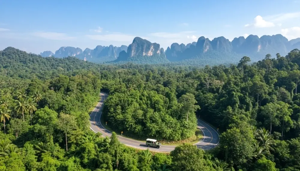
The Mae Hong Son Loop is not merely a transport link between towns. It is one of those rare journeys that changes how you see a country. This 600-kilometre circular route transitions from the sophisticated coffee culture of Chiang Mai’s Nimman Haemin neighbourhood to the misty, teak-built stillness of the Burmese border, passing through river valleys, cloud forest, Shan temples, and Karen villages along the way. The humidity of the lowlands gives way to the sharp clarity of high-altitude passes. The views are extraordinary. The curves are relentless. And the whole thing is completely, thoroughly worth it.
Whether you are a seasoned rider treating this as a bucket-list motorcycle route, a couple in a hired car taking it slow over a week, or a first-time visitor to northern Thailand trying to understand what lies beyond Chiang Mai, the Mae Hong Son Loop rewards every type of traveller who commits to it.
The Quick Summary
Route Distance: 600 kilometres with 1,864 hairpin curves.
Optimal Duration: 4 to 7 days to allow for deep exploration of remote villages, cave systems, and off-road side trips. Budget travellers push it faster; those who want the full experience slow down.
Daily Budget Expectation: 1,200 to 2,800 THB (~36 to 84 USD) per day covering bike rental, fuel, and guesthouse accommodation. Add more for boutique stays and guided treks.
Best Season: November to February for crisp mountain air, clear skies, and morning mist in the valleys. Avoid March and April entirely due to the burning season.
Key Destinations: Chiang Mai, Pai, Mae Hong Son town, Mae Sariang, and the hidden villages in between.
Direction: Most riders go counter-clockwise: north via Route 1095 through Pai to Mae Hong Son, then south through Mae Sariang on Route 108 back to Chiang Mai. This front-loads the technical climbing and rewards you with gentler forest roads on the return.
Compare hotel prices across Northern Thailand’s
best areas and book with confidence.
Filter by budget, location, or score
to find the right stay for your trip.
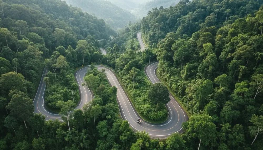
Mastering the 1,864 Curves
The numbers are not exaggerated. The Mae Hong Son Loop contains 1,864 documented curves, the majority of them on the northern section between Chiang Mai and Mae Hong Son via Pai. Understanding the route segments before you leave saves you from being caught out by distance or condition changes after dark.
| Segment | Distance | Key Landmark | Road Condition |
|---|---|---|---|
| Chiang Mai to Pai | 130 km | Memorial Bridge | Extremely steep, 762 curves |
| Pai to Mae Hong Son | 105 km | Tham Lod Cave | High altitude, sweeping views |
| Mae Hong Son to Mae Sariang | 165 km | Khun Yuam | Remote, heavy forest cover |
| Mae Sariang to Chiang Mai | 190 km | Doi Inthanon National Park | Good surface, wide valleys |
A practical rule: never plan to cover more than 150 kilometres in a single day on the northern section. The curves are not difficult individually, but the cumulative concentration is mentally demanding, and the scenery is too good to rush through. Give yourself permission to stop whenever something looks worth photographing, which on this route is roughly every ten minutes.
Preparing in Chiang Mai Before You Leave
Chiang Mai is the natural launch point for the loop and the best place to sort logistics before hitting the mountains. Spend at least a day here getting organised.
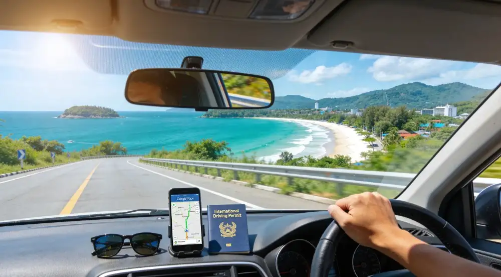
Vehicle rental: The most popular choice is a semi-automatic or automatic scooter (110 to 150cc) for budget riders, or a Honda CRF or similar trail bike (150 to 250cc) for more experienced riders who want confidence on steep gradients. Daily rental in Chiang Mai runs 250 to 600 THB (~7.50 to 18 USD) depending on the bike and rental shop. Hiring a car is a strong option for families or groups; a small SUV handles the curves well and provides far better visibility on Route 1095 than a sedan. Use Welcome Pickups or local rental agencies for fixed-price private car hire with proper insurance documentation.
Documentation: Carry your passport, home country driving licence, and an International Driving Permit (IDP). Police checkpoints operate regularly around Chiang Mai and at various points on the loop. Riding without a valid IDP typically results in a 500 THB fine and may void your travel insurance entirely in the event of an accident.
Connectivity: Pick up a local AIS SIM card at Chiang Mai Airport or in the city before leaving. AIS provides the most consistent rural coverage across the northern hills. Alternatively, activate an Airalo, Yesim, or Saily eSIM before you fly so your maps and messaging apps work from the moment you collect your vehicle. Grab functions in Chiang Mai but stops being useful once you leave the city; from Pai onwards, you are on your own or relying on local songthaews.
Cash: Withdraw enough Thai Baht to cover the full loop before leaving Chiang Mai. ATMs in Pai are reliable but charge foreign transaction fees of around 220 THB (~6.50 USD) per withdrawal. Mae Sariang and smaller villages between towns are strictly cash environments. Plan on carrying at least 3,000 to 5,000 THB in notes at all times once you pass Pai.
Accommodation: Agoda shows strong inventory for guesthouses along the loop, including smaller boutique stays in Mae Hong Son town and Mae Sariang that do not always appear on western booking platforms. Book at least the first and last nights in advance during the high season from November to February; the middle nights can be handled on the road with relative ease outside peak holiday periods.
The Ascent to Pai: Beyond the Backpacking Hub

Pai is reached via Route 1095, an intensive mountain pass containing 762 of the loop’s total curves. The climb begins shortly after leaving the Mae Taeng district and does not relent until the road drops into Pai’s river valley. Air temperature falls noticeably as elevation increases. By the time you arrive, the lowland heat of Chiang Mai feels like a different country entirely.
Pai has a reputation as a social hub for backpackers and this is largely deserved, but the town’s real value for loop riders lies in its surrounding geography. The canyon viewpoint at Pai Canyon offers one of the most dramatic sunset panoramas in the north. Pam Bok Waterfall, tucked behind tall limestone cliffs, is a 20-minute walk from the road and almost always quiet. The Land Split, a strange geological fault in a local farmer’s field, is genuinely surreal and costs almost nothing to visit.
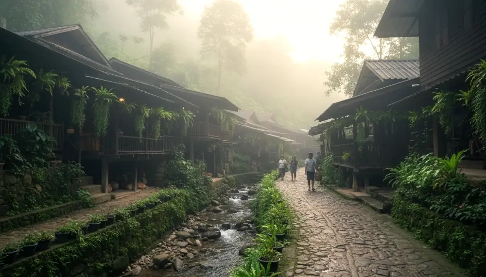
For something completely off the typical tourist circuit, ride out to Santichon Village: a Yunnanese Chinese settlement in the hills above Pai where traditional mud-brick houses still stand and high-mountain oolong tea is sold directly from the growers. Premium teas here range from 150 to 800 THB (~4.50 to 24 USD) per pack and are far better value than anything sold in Chiang Mai’s tourist shops.
Cultural note: when entering village shops, homestays, or temples such as Wat Phra That Mae Yen, remove your footwear without being asked. Tipping at local eateries is not expected, but leaving 10 to 20 THB as a gesture of appreciation is always received warmly.
Pai is also a sensible place to add a rest day. After the physical concentration required for 762 curves, a slow morning with coffee and a view of the rice fields before continuing west is not wasted time.

From temples to island tours, Klook
covers Northern Thailand’s best experiences.
Hotel pickup is often included and
prices beat the pier walk-in rate.
Mae Hong Son: The Misty City of Three Mists
As the road levels out into the valley of Mae Hong Son, the atmosphere shifts completely. Mae Hong Son city is the cultural heart of the loop, characterised by Shan (Tai Yai) influence and Burmese-style temple architecture that stands in stark contrast to the Central Thai temples most visitors encounter in Bangkok.
The focal point of the town is Jong Kham Lake. In the early morning, mist drifts across the water and the twin temples, Wat Chong Kham and Wat Chong Klang, reflect on the surface with perfect stillness. The architecture of Wat Jong Klang shows deep Burmese heritage in its intricate white carvings and tiered rooflines. This is one of the most photogenic spots in all of northern Thailand and it costs nothing to stand at the lakeside at dawn and take it in slowly.
Above the town, Wat Phra That Doi Kong Mu sits on a hilltop with panoramic views of the valley and surrounding mountains. The climb is short and the views from the top are exceptional, particularly in late afternoon light.
For an experience that goes well beyond the standard tourist circuit, ride north from Mae Hong Son to Ban Rak Thai. This village sits on the edge of a reservoir right on the Myanmar border and was originally settled by former Kuomintang soldiers who retreated here in the 1950s. The morning mist rolling over the water while locals harvest tea leaves from the surrounding hillside is a sight that completely defies the typical tropical image of Thailand. Premium tea from Ban Rak Thai ranges from 300 to 1,500 THB (~9 to 45 USD) depending on grade and processing, and the quality is genuinely exceptional.
Plan at least two nights in Mae Hong Son. One night is not enough to absorb what this town offers.

Skip-the-line tickets and guided walks
in Northern Thailand with English-speaking
guides. Read real traveller reviews
before committing to a single one.
Pro Tips For Stress-Free Travel

Digital navigation and reliable connectivity are essential for the remote stretches of the Mae Hong Son Loop. Use Agoda for boutique stays along the route, download Google Maps offline before leaving Chiang Mai, and carry either a local AIS SIM card or a pre-activated Airalo, Yesim, or Saily eSIM for the best rural data coverage in the northern hills.
Currency: While many places in Chiang Mai and Pai accept cards, Mae Sariang, Ban Rak Thai, and most villages along the route are strictly cash (THB) environments. Withdraw generously before leaving each town.
Booking Activities: Get Your Guide and Klook are both useful for pre-booking guided cave tours at Tham Lod, trekking day trips from Mae Hong Son, and cultural village experiences with vetted local operators.
Grab and Local Transport: Grab functions in Chiang Mai but becomes irrelevant once you enter the mountains. From Pai onwards, rely on your own rental vehicle, local songthaews for short hops, or private drivers hired at guesthouses. For airport and city transfers on arrival and departure, Welcome Pickups offers fixed-price private cars with proper documentation.
Security on Public Wi-Fi: Use NordVPN when connecting to guesthouse Wi-Fi anywhere on the route to protect banking data and personal accounts, particularly when using Thai QR payment systems from shared networks.
Flight Disruptions: If you are flying into Chiang Mai to start the loop, AirHelp provides compensation claim support for delayed or cancelled flights, which can offset costs if your journey is disrupted before you even reach the mountains.
Long-Stay Medical Cover: For extended northern Thailand trips or anyone combining the loop with a longer digital nomad stay, SafetyWing offers flexible rolling travel medical insurance with no fixed return date requirement.
Returning via Mae Sariang: The Quiet Road Home
The southern leg of the loop from Mae Hong Son to Chiang Mai via Route 108 through Mae Sariang is a different experience to the northern half entirely. Where the Chiang Mai to Pai section demands concentration and rewards you with relentless drama, the southern route is more forested, more open, and considerably more peaceful. It offers a natural decompression after the intensity of the mountains.
Before leaving Mae Hong Son, fuel up at the PTT station in town. The stretches between towns on this southern leg are sparsely populated and petrol stations are few and far between. Do not leave Mae Hong Son with less than a full tank.
The first major stop heading south is Khun Yuam, a small town famous for its sunflower fields that bloom spectacularly from November through January. The World War II Museum here is a sobering and surprisingly moving stop, documenting the Japanese retreat through this valley in 1945 with original artefacts and personal accounts.
Mae Sariang itself is one of the most underrated towns in northern Thailand. It sits on the Salween River near the Myanmar border and has barely been touched by mass tourism. The town is a historic centre for teak trade and Karen culture, and the riverside temples here have a quiet dignity that busy tourist stops often lack. Mae Sariang is also where the practical economics of the loop feel most honest: riverside restaurants with 10% service charges and 7% VAT added to the bill still come to totals far lower than equivalent meals in Chiang Mai.
Spend a night in Mae Sariang rather than pushing through to Chiang Mai in a single day. The guesthouses here are excellent value, the food at the night market is exceptional, and waking up to mist on the Salween is one of those quiet moments that the loop rewards you with unexpectedly.
From Mae Sariang, the final section south and east to Chiang Mai via Route 108 is well surfaced and considerably less technical than anything that came before. Budget three to four hours and consider a detour through Doi Inthanon National Park, Thailand’s highest peak, as a final flourish before returning to the city.

Confidence Booster: Road Safety and Practical Riding Advice

The Mae Hong Son Loop is safe for experienced riders and drivers, but the mountain roads demand genuine respect. The surface quality is generally very good by Southeast Asian standards, but gravel washing onto corners after rain, wandering livestock, and slow agricultural vehicles are all regular features. Plan for them rather than being surprised by them.
For motorcycle riders: Choose a bike with at least 150cc; anything smaller will labour on the extended climbs and reduce your margin of safety on steep descents. Wear full protective gear regardless of the heat. A helmet, gloves, and proper riding boots are not optional on this route. Keep headlights on at all times and never overtake on blind curves, which on Route 1095 means exercising patience almost constantly.
For car drivers: A small SUV is the ideal choice. The road is fully paved and a standard sedan can manage it, but an SUV gives you better visibility on tight mountain curves and more confidence on steep gradients. Use low gear on descents to preserve brakes.
For those not comfortable driving themselves: Private drivers can be hired through guesthouses in Chiang Mai for approximately 2,500 to 3,500 THB (~75 to 105 USD) per day plus fuel. This is genuinely good value for groups of three or more and allows everyone to simply watch the scenery rather than concentrating on the road.
Emergency contact: The Tourist Police are accessible via the 1155 app and are consistently helpful and English-speaking throughout northern Thailand. Save the number before you leave Chiang Mai. Your rental shop should also have an emergency contact number; confirm this when you collect the vehicle.
Night riding: Avoid riding after dark on any section of the loop. The road markings are good but lighting is non-existent beyond towns, wildlife crossings are unpredictable, and the visual reward of the route is entirely lost in darkness. Set daily distance targets that get you to your next stop well before sunset.
Food and Fuel Along the Loop
Eating on the Mae Hong Son Loop is one of its underrated pleasures. Northern Thai cuisine has a distinct identity shaped by Shan, Burmese, and Yunnanese influences, and every town along the route has its own specialities worth stopping for.
In Pai, the night market and riverside cafes cover everything from Thai street food to excellent Western breakfasts for those who need a familiar start to a demanding riding day. Khao Soi, the rich coconut curry noodle soup topped with crispy noodles, is ubiquitous and exceptional throughout the region. A bowl costs 60 to 100 THB (~1.80 to 3 USD).
In Mae Hong Son, the morning market near Jong Kham Lake is the best single food stop on the entire loop. Shan-style noodle soups, grilled meats, and fresh market produce make for an outstanding breakfast at around 60 to 80 THB (~1.80 to 2.40 USD) total. The local specialty is Khanom Jeen, rice vermicelli served with a choice of broths, typically available only in the early morning.
In Mae Sariang, the riverside restaurants along the Salween are a genuine highlight. Fresh river fish, northern Thai curries, and cold Singha beer with a view of Myanmar across the water make for a meal worth scheduling time around.
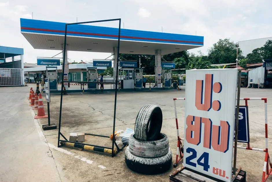
On fuel: fill up at every opportunity in larger towns. PTT and Bangchak stations are the most reliable. Between towns on the southern leg especially, you will occasionally pass small roadside fuel sellers with hand-pumped petrol in bottles; these are fine for top-ups but not a substitute for a proper fill before leaving Mae Hong Son or Mae Sariang.
Who This Route Is For
The Mae Hong Son Loop works for a broader range of travellers than its reputation as a motorcycle route suggests. Yes, it is a dream for riders. But it is equally rewarding for couples in a hired car taking a leisurely week through the mountains, families looking for a different kind of Thai adventure away from the beach circuit, digital nomads combining a working week with genuinely spectacular scenery, and first-time visitors to the north who want to understand what lies beyond the tourist trail.
The key is giving yourself enough time. Four days is the minimum for a meaningful loop experience. Seven days, with rest days in Pai and Mae Hong Son and a proper overnight in Mae Sariang, turns it into something you will be describing to people for years.
Thailand’s southern coast gets most of the attention. The north gets the roads. And roads like this are why people come back.
Frequently Asked Questions
Do I need an International Driving Permit (IDP) for the Mae Hong Son Loop?
Yes. To legally drive or ride in Thailand and satisfy insurance requirements, you must carry a valid IDP alongside your home country driving licence. Police checkpoints operate regularly around Chiang Mai and at several points along the loop. Riding without a valid IDP typically results in a 500 THB fine and, more importantly, may void your travel insurance entirely if you are involved in an accident. Apply for your IDP through your national motoring association before travelling; most issue them within a few days.
Is the Mae Hong Son Loop possible in a car?
Absolutely, and for many travellers a car is the more practical and comfortable choice. A standard sedan can handle the route, but a small SUV is strongly recommended for better visibility on the tight mountain curves of Route 1095 and more confidence on steep gradients. A car also allows more luggage, better weather protection, and a more relaxed experience for passengers who want to focus entirely on the scenery rather than the road. Private drivers can be hired in Chiang Mai for approximately 2,500 to 3,500 THB (~75 to 105 USD) per day plus fuel.
What is the Burning Season and why should I avoid it?
From late February through April, farmers across northern Thailand clear agricultural land using controlled burning. The smoke from thousands of fires becomes trapped in the mountain valleys, creating serious air quality issues and obscuring the mountain views that make the loop worth doing. During peak burning season, visibility can drop to a few hundred metres and the air quality in enclosed valleys like Pai and Mae Hong Son becomes genuinely unpleasant. Avoid this period entirely. The loop is at its best from November through February.
How much does fuel cost for the entire loop?
Expect to spend between 1,200 and 2,500 THB (~36 to 75 USD) on fuel for a complete loop, depending on your vehicle’s fuel efficiency and how many side trips you take to remote viewpoints or villages. Motorcycles are considerably cheaper to run than cars. Always fill up in major towns: Chiang Mai, Pai, Mae Hong Son, and Mae Sariang all have reliable petrol stations. The stretches between these towns, particularly on the southern leg, have very few fuel stops, so leaving any town with less than a full tank is a risk not worth taking.
How many days should I allow for the full loop?
Four days is the absolute minimum for a meaningful experience, and it will feel rushed. Most travellers find five to six days the sweet spot: one night in Pai, two nights in Mae Hong Son, one night in Mae Sariang, and a final drive back to Chiang Mai. Seven days or more allows for rest days, proper trekking excursions from Mae Hong Son, a visit to Ban Rak Thai on the Myanmar border, and the kind of slow exploration that makes this route genuinely memorable rather than simply completed.
Which direction should I ride the loop?
Counter-clockwise is the standard recommendation and for good reason. Starting north via Route 1095 through Pai to Mae Hong Son front-loads the most technically demanding curves while you are fresh, and the descents coming into Mae Hong Son from the north are spectacular. Returning via the southern Route 108 through Mae Sariang gives you a progressively more relaxed final section that feels like a natural wind-down. Clockwise is also possible and some experienced riders prefer it, but counter-clockwise is the easier introduction for first-timers.
What mobile data and connectivity should I use on the loop?
AIS provides the most consistent coverage across the northern hills and is the strongest choice for rural signal throughout the loop. Pick up a physical AIS SIM at Chiang Mai Airport or in the city before leaving, or activate an Airalo, Yesim, or Saily eSIM before you fly so your apps work from the moment you collect your vehicle. Download Google Maps offline for the entire route before leaving Chiang Mai. Signal drops in deep valleys between towns, so never rely on live navigation alone. Grab stops functioning beyond Chiang Mai; from Pai onwards, local songthaews and your own vehicle are your transport options.
Where should I stay on the loop?
Pai has the widest range of accommodation from budget bamboo bungalows at 300 to 500 THB (~9 to 15 USD) per night up to boutique riverside villas. Mae Hong Son town has excellent mid-range guesthouses with lake views from around 600 to 1,500 THB (~18 to 45 USD) per night. Mae Sariang is largely undiscovered and offers outstanding value: comfortable riverside guesthouses for 400 to 800 THB (~12 to 24 USD) per night. Agoda consistently shows the strongest inventory for smaller boutique properties along this route. Book your first and last nights in advance during the November to February high season; the middle nights can usually be arranged on the road.
What should I pack for the Mae Hong Son Loop?
Pack light: panniers or a tank bag are far more manageable than a backpack on the mountain roads. Essentials include a quality helmet (bring your own or hire one from a reputable shop in Chiang Mai), riding gloves, closed-toe shoes at minimum and proper riding boots ideally, a light waterproof layer for mountain passes and afternoon rain, sunscreen and lip balm for high-altitude sun exposure, and a small first-aid kit. Carry sufficient cash for two to three days at all times; ATMs in Pai are reliable but charge foreign fees, and Mae Sariang onwards is largely cash-only. A physical AIS SIM or pre-loaded eSIM is essential before leaving Chiang Mai.
What are the best stops beyond the main towns?
The highlights that most riders miss include: Santichon Village near Pai for Yunnanese Chinese culture and exceptional high-mountain oolong tea; Tham Lod Cave between Pai and Mae Hong Son for bamboo raft cave exploration with lantern guides; Ban Rak Thai north of Mae Hong Son for mist over the Myanmar border reservoir and premium tea direct from growers; Khun Yuam on the southern leg for November sunflower fields and the World War II Museum; and the Salween National Park viewpoints on the Mae Sariang to Chiang Mai stretch. None of these require significant detours and all of them add considerably to the experience.